

Weather
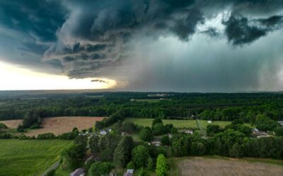
Relentless 2026 Heat Wave Sets All-Time Records Across the West as Tropical Storm Adds to Misery in the South
A punishing heat wave has gripped large swaths of the country for weeks this summer, shattering all-time temperature records from Montana to Arizona, while Tropical Storm Bertha brought a rare and dangerous combination of extreme heat and tropical weather to the Gulf Coast. Records Falling Across the West Salt Lake City, Utah, recorded a new all-time high of 109°F, while Miles City, Montana, and Sheridan, Wyoming both set all-time records at 115°F and 109°F, respectively. Phoenix, Arizona reached highs of 113°F over several consecutive days, part of a second heat dome that formed across the western and central U.S. in early July, layering on top of an earlier heat dome that had already scorched the eastern half of the country ahead of the July Fourth holiday, placing more than 160 million Americans under heat alerts at its peak. A Rare Combination in the South The Gulf Coast saw an unusual double threat when Tropical Storm Bertha made landfall, prompting southern Louisiana to be placed under both a tropical storm warning and an extreme heat warning simultaneously — the first time that combination has occurred in the region since 2005. Lake Charles recorded a heat index of 121°F during the storm. Wildfire Smoke Compounds the Problem Adding to the discomfort, smoke from ongoing Canadian wildfires has drifted into parts of the Northeast, worsening air quality in areas like Pennsylvania’s Lehigh Valley even as temperatures there tied daily heat records. What’s Behind It Meteorologists point to a combination of factors driving the summer’s extreme and prolonged heat, though the pattern of back-to-back heat domes settling over different regions of the country has made this one of the more geographically widespread heat events in recent memory. Emergency officials continue to urge residents in affected areas to check on elderly neighbors, stay hydrated, and limit outdoor activity during peak afternoon heat as the pattern shows few signs of fully breaking in the near term. This story is developing.

The Burning Continent: Massive Heat Dome Shatters European Records as Excess Deaths Top 1,300
A climate emergency of historic proportions has engulfed the European continent. An immovable, stagnant “heat dome”—fueled by a massive atmospheric high-pressure system drawing scorched air directly northward from the Saharan desert—has systematically shattered all-time temperature records from the British Isles to the deep interior of the Balkans. The compounding, weeks-long meteorological event has forced millions of citizens under top-tier “Red Alerts,” crippled critical energy and transport infrastructure, and triggered an escalating humanitarian crisis. The World Health Organization (WHO) and regional ministries have already confirmed more than 1,300 excess deaths directly linked to the suffocating daytime peaks and sweltering overnight minimums. At The Modern Memo, we break down the localized data defining Europe’s most severe early-summer heatwave on record, the structural collapse of cooling and transport infrastructure, and the alarming shifting of the heat dome into Eastern Europe. Shattering the Baseline: The Broad-Spectrum Data The primary shock of the heatwave is its immense geographic scale and the sheer margins by which multi-decade temperature benchmarks have been obliterated across Western and Central Europe. The French Crucible: France experienced its hottest days since records began in 1947, with the national average temperature hitting an unprecedented 30.0°C. The mercury peaked at a blistering 44.3°C in the southwestern town of Pissos, while Paris sweltered through a record-breaking June high of 40.9°C. Météo-France placed 58 departments under an emergency Red Alert as the government restricted public events. The Spanish Peak: The absolute highest temperature of the cycle materialized in Andújar, Spain, where the thermometer topped out at a lethal 45.1°C. In northern Spain, the coastal city of Bilbao hit a historic June peak of 42.7°C, severely worsening an ongoing regional drought. The Northward Surge: The heat dome effectively bypassed natural geographical buffers. Germany reported an all-time record of 41.7°C in the eastern town of Coschen, with 46 distinct weather stations crossing the 40-degree threshold. The Netherlands (39.4°C), Switzerland (39.0°C in Basel), and Denmark (37.0°C) all provisionally logged their hottest June days in recorded history. The UK’s Unprecedented Red Alert: The United Kingdom’s Met Office issued Red Warnings for Extreme Heat for three consecutive days—the first time in the history of the current warning system that top-tier alerts were maintained for three straight days—as temperatures in southern England surged to a provisional June record of 37.3°C. The Critical Inversion: When Night Brings No Relief Public health experts and climatologists at World Weather Attribution (WWA) warn that the primary driver behind the surging mortality rate is not just the blinding daytime heat, but a total lack of nocturnal cooling. When nighttime temperatures remain above 25°C, the human cardiovascular system is blocked from shedding internal heat, drastically escalating stroke and cardiac arrest risks for elderly and medically vulnerable populations. A rapid historical attribution study finalized by climate scientists concluded that a multi-day June heatwave of this intensity would have been “virtually impossible” in the mid-20th century, noting that the hot daytime peaks have become ten times more likely, while the dangerous tropical nights are now 100 times more likely due to a warmed global climate baseline. Infrastructure Structural Failures: Steel, Power, and Pavement The sheer persistence of the high-pressure block has exposed the severe vulnerability of European public infrastructure, which was fundamentally designed for a cooler, mid-twentieth-century climate. Medical Emergency Overload: The sudden influx of heatstroke and dehydration cases has placed immense strain on localized healthcare networks. In the UK, multiple NHS trusts and East Surrey Hospital declared “critical incidents” after aging building cooling units suffered structural failures, forcing facilities to restrict admissions to life-threatening emergencies only. Transport and Grid Paralysis: Across France and Germany, rail networks were thrown into chaotic delays as extreme surface temperatures triggered the thermal expansion of steel tracks, threatening train derailments and snapping overhead power lines. Concurrently, electricity demand for air conditioning surged to a 45-year high, straining grids right as low river levels and high water temperatures forced power plants to curtail generation to prevent ecological damage. The Wildfire Axis: The intense heat has rapidly vaporized soil moisture, pushing forest and brush ecosystems to record seasonal lows. Out-of-control wildfires have broken out across southern France and central Spain, stretching emergency services to their absolute limits. Shifting the Dome: The Crisis Moves East As the final days of June draw to a close, real-time tracking data from the European Centre for Medium-Range Weather Forecasts (ECMWF) indicates that the core of the heat dome has officially shifted eastward, placing a fresh swathe of vulnerable nations in the crosshairs. The Balkan Red Alert: Atmospheric models show the core of the stagnant high-pressure system centering directly over Central Europe and the Balkans. Red warnings have been hoisted across Hungary, Poland, Romania, Serbia, and Slovakia. The New Targets: Slovakia has already recorded a new national benchmark of 40.5°C near its southern border, while Budapest is modeling temperatures forecast to cross the 41-degree mark. The Ukraine Grid Strain: The eastward migration is presenting a catastrophic test for Ukraine’s infrastructure. Already severely degraded by years of ongoing conflict, the nation’s state energy providers warned that temperatures approaching 38°C are forcing the power grid into a “very strained mode,” prompting emergency rolling blackouts to prevent total system collapse. Final Word The unprecedented, record-shattering heat dome blanketing Europe is the definitive proof that climate change is no longer a distant, abstract projection for future generations—it is a lethal, contemporary reality. When you look past the standard tourism cancellations and look directly at the raw meteorological data—temperatures consistently breaching 44°C in France and Spain, the structural collapse of medical cooling units and railway networks across the UK, and more than 1,300 preventable deaths recorded in a matter of weeks—you gain an unvarnished view of a continent physically unequipped for its new climate baseline. Quality information replaces the casual summer travel narratives with the cold reality of a systemic public health emergency. As the oppressive heat dome slowly drifts eastward to bake the Balkans and strain Ukraine’s grid, European leaders are being handed a permanent, unyielding warning: if cities do not aggressively invest…
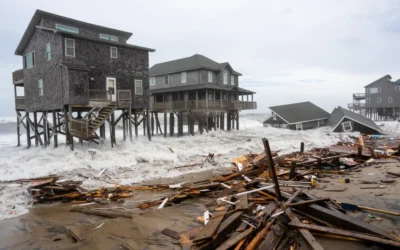
Atlantic Fury: North Carolina Homes Collapse into the Ocean
Recent storms battered the North Carolina coast, and the damage was dramatic. On September 30, powerful waves generated by Hurricanes Humberto and Imelda caused at least six beachfront homes in Buxton—on the Outer Banks—to crumble and fall into the sea. Fortunately, no one was hurt because the houses were unoccupied at the time. These collapses highlight how vulnerable the barrier islands are to erosion, shifting sands, and storm surge. This is not the first time it has happened. Since 2020, nearly 20 privately owned homes in the same region have already been lost to surf and erosion. (MORE NEWS: General Motors CEO Pulls Back on EV Ambitions) Storms Offshore, Damage Onshore Although both Humberto and Imelda stayed offshore, their effects reached the coast. Hurricane Imelda, despite not making landfall, pushed strong winds, rain, and heavy surf toward the U.S. East Coast. Meanwhile, Humberto added to the turmoil by sending more swells toward the shoreline of North Carolina. Because the storms remained out at sea, many inland areas escaped serious flooding and wind damage. However, the surf zones bore the full force of pounding waves. The National Park Service warned that hazardous debris and shifting sands would linger along the beaches and require caution for days. The Collapse: How It Happened In Buxton, five houses on stilts collapsed within a 45-minute span on Tuesday afternoon. Later that night, a sixth home fell. Dramatic footage showed one structure swaying precariously before disintegrating and plunging into the surf. Wood, debris, and pieces of siding littered the beach in the aftermath. Drone video captured homes that collapsed into the ocean on North Carolina’s Outer Banks on Tuesday amid rough surf from dual hurricanes off the Southeast coast. Five homes fell within a 45-minute period on Tuesday afternoon, and a sixth fell overnight. https://t.co/f8zQoRYVLd pic.twitter.com/U66IOjihPN — AccuWeather (@accuweather) October 1, 2025 These were not ordinary homes. Most were built on pilings or stilts to protect against tides, but the combined assault of waves and undermined foundations proved too much. The erosive power undercut the supports until the structures lost balance and tipped into the water. Officials closed off the area around the collapses. They also shut down parts of Highway 12 and halted ferry service between Ocracoke and Hatteras, citing danger from debris and unstable roadways. Official Response: National Park Service and Local Agencies The National Park Service (NPS) has confirmed the collapse of the homes and urged caution. A spokesperson for the Cape Hatteras National Seashore said staff were actively working to remove debris and monitor risk areas. They also told the public to avoid walking on the beach near the collapse zone. In a previous collapse in Buxton, NPS officials said they would clean the area south of the site, and the homeowner had hired a contractor to remove remaining structure and debris. That incident was the 12th home to collapse along the seashore in five years. Dare County’s Planning Director, Noah Gillman, has also weighed in. He noted that more than 30 structures in the area had been decertified for occupancy due to erosion damage, including harm to stairs and septic systems. He pointed out that many of the collapsed properties had already lost the required separation from the shoreline. Local governments are now discussing options such as potential relocations, stricter setbacks, or buyouts. Officials from the North Carolina transportation department closed parts of Highway 12 and halted ferry crossings in the area until safety could be assured. The closures aimed to protect residents and travelers from danger posed by debris, shifting sands, and instability. A Coast Under Pressure These events are part of an ongoing struggle along the Outer Banks, North Carolina. Beach erosion has steadily eaten away at the shoreline, leaving some homes standing precariously close to the surf. Even when storms remain offshore, their wave energy can be destructive enough to trigger collapses like those seen in Buxton. The geography of the barrier islands makes them particularly vulnerable. Shifting sands, narrow beaches, and exposure to open Atlantic swells mean that conditions can change quickly. For residents and property owners, this creates constant uncertainty. The Human and Policy Dimension While no one was injured in these North Carolina collapses, the impact on property owners and the community is significant. For many, these homes represented investments, memories, and part of the local economy. Their loss raises difficult questions about the future of oceanfront development. Local officials face the challenge of balancing safety, tourism, and property rights. Stronger building codes and better enforcement of setback requirements may help, but erosion continues to place many structures at risk. In some cases, officials may have to consider buyouts or relocation programs for the most threatened properties. The costs of cleanup also fall on local agencies and the National Park Service. Debris removal, beach safety patrols, and roadway repairs require time, labor, and funding. Looking Ahead: Lessons and Warnings North Carolina is no stranger to hurricanes and flooding. But the collapse of homes in Buxton is still a stark reminder that the ocean’s power should never be underestimated. Even when hurricanes remain offshore, the waves and surf they generate can cause serious destruction. When homes are built too close to the waterline in areas that see high water during hurricanes, disaster is not a surprise — it is expected. The ocean shifts beaches, pushes storm surge inland, and leaves little margin of safety for houses standing only feet from the tide. And this isn’t about climate change. You can’t blame the consequences of risky building decisions on the climate. When people choose to build in the path of storm surge and pounding waves, the risk is built in from the start. The shoreline is always moving. Homes positioned too near the surf will remain in jeopardy, and events like this will continue to shape the future of the Outer Banks. By planning ahead and preparing, local communities may reduce losses — but the ocean’s power will always be a formidable force. Unmask the Narrative….
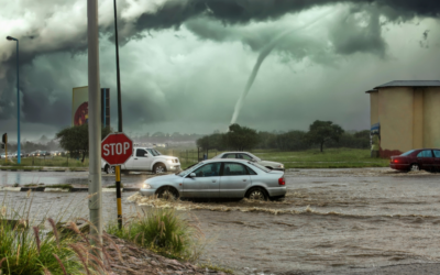
Hurricane Warnings Ramp Up For Summer With ‘Above Normal’ Forecast
Atlantic hurricane season starts this month and pretty much no one is excited for it, especially since it may be an “above” average year. Hurricane season start on June 1 and runs through November 30 each year, according to Live Science. This turbulent time in our annual calendar could be 60% more active than normal, the National Oceanic and Atmospheric Administration said in late May. Anywhere from 13 to 19 named tropical storms are anticipated, with anywhere from six to 10 of them turning into hurricanes. Thankfully, NWS has predicted highly active hurricane seasons for as long as any of our editorial team can remember. It is smarter to over-warn and under-deliver when it comes to Mother Nature, especially with so many of our major cities and urban centers lying in flood zones. Is This A Fair Forecast? Even in the most recent forecast, LiveScience notes that “normal” years see roughly 14 named storms, seven of which become hurricanes, with three being classed as “major” hurricanes. Is it fair to say that a forecast ranging from under to slightly over the “average” is so significantly “above normal?” Technically, yes. Socially … no. This will probably (hopefully) be a hurricane season like any other … we pray. (MORE NEWS: Best Crops To Grow During A Nuclear Apocalypse, According To Scientists) “NOAA has a 70% confidence in its predictions of this year’s storm frequency. Last year, before the 2024 hurricane season, NOAA predicted that there would be 17 to 25 named storms, eight to 13 hurricanes, and four to seven major hurricanes — an even more severe forecast than this year’s outlook. However, the season actually resulted in 18 named storms, 11 hurricanes, and five major hurricanes,”the outlet wrote. What Prompted The Forecast? Warmer-than-average water temperatures in our oceans and potential for high activity throughout the West African Monsoon season. “This outlook is a call to action: be prepared. Take proactive steps now to make a plan and gather supplies to ensure you’re ready before a storm threatens,” NWS Director Ken Graham said in a statement. (RELATED: Guys, We May Have Found The Most Addictive New Outdoors Show On YouTube) Graham’s comments come a year after members of Congress wrote him to express serious concerns about reports of NWS network and equipment outages during extreme weather events. What Will The 2026 Storms Be Named? Andrea, Barry, Chantal, Dexter, Erin, Fernand, Gabrielle, Humberto, Imelda, Jerry, Karen, Lorenzo, Melissa, Nestor, Olga, Pablo, Rebekah, Sebastien, Tanya, Van, and Wendy. (RELATED: Soviet Spacecraft May Hit US Thanks To Uncontrolled Reentry) “NOAA and the National Weather Service are using the most advanced weather models and cutting-edge hurricane tracking systems to provide Americans with real-time storm forecasts and warnings,” Commerce Secretary Howard Lutnick said in a statement shared by NOAA. “With these models and forecasting tools, we have never been more prepared for hurricane season.” Hurricane helene, Boone NCpic.twitter.com/OYskw00jqW — Terrifying Nature (@TerrifyingNatur) October 2, 2024 Trucks hauled away debris piled up at a city park in Treasure Island, Florida, following Hurricane Milton. pic.twitter.com/Bs2tBvt0G0 — AccuWeather (@accuweather) October 28, 2024 HurricaneSandyAftermathHobokenFloodedStreet TMM Analysis Hurricane season is only a threat if you ignore the warnings. On the TMM Scale of Danger, we’d rank them a 0/10 if you get out of dodge; a 10 if you’re an idiot and stick around to ride out the carnage. Don’t believe us? Go back and watch the videos above. One of the other things we recommend most folks do is check out the NOAA Seven-Day Graphical Tropical Weather Outlook, which is a pretty accurate (and cool) tool for seeing storms as they develop over our oceans.